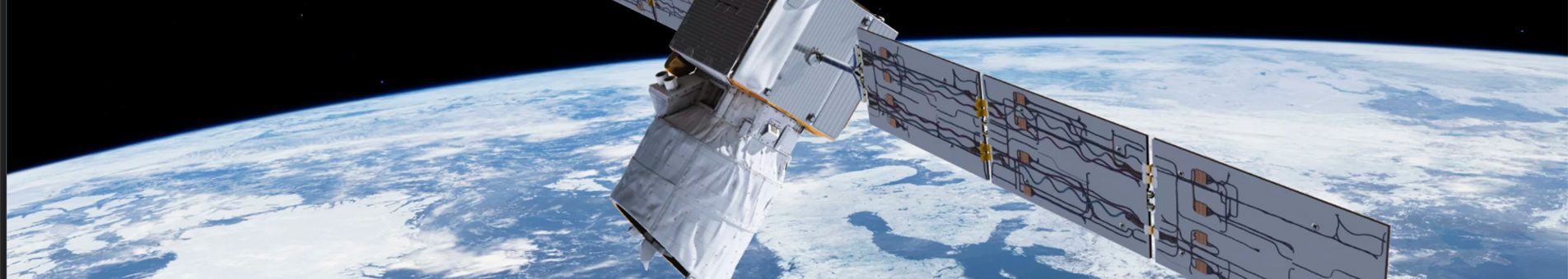
SATELLITE AEOLUS
The ESA (European Space Agency) named this satellite as Aeolus, coming from Greek mythology, Eolo (in Greek), is known as the father of the race eolia, the lord and god of the winds. What is intended with this satellite is to gather accurate information about the winds, not achieved so far. Becoming the first satellite to do it directly from space and collecting the necessary information to understand how the winds, atmospheric pressure, temperature and humidity are related, in a layer of 30,000 meters from the surface of the Earth.

ESA Imagen
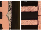
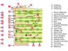
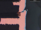
Alter Technology supplied and tested electronic components for several customers during the years 2003 to 2006.
It has been over 15 years and almost 500 million euros invested to design and put into orbit this satellite. So far there were no measuring instruments at this point; with the launching into orbit of Aeolus measurements will be obtained at all altitudes, from the surface and the troposphere to 30 km in the stratosphere, as explained by the European agency. ESA Director General, Jan Wörner, said, “Aeolus embodies the essence of the Earth’s explorers.” With pioneering laser technology to calculate wind speed, it is intended to remedy one of the greatest shortcomings of the Global Observing System, that is, the lack of direct and global measurements of winds, as explained by ESA at the press.
Thanks to the innovative technology installed at the satellite, a tool that generates impulses of ultraviolet light emitted into the atmosphere promises to achieve the first global map of the winds of the Earth, thus being able to know the atmospheric dynamics. With these data the mission will reveal and give us knowledge of the movements of the wind and how it affects the exchange of temperature and humidity between the earth’s surface and the atmosphere, and in this way understand how heat is redistributed, how hurricanes are generated … , key aspects to know and understand how it affects climate change.

ESA Imagen
One of the advantages of putting the Aeolus into orbit is that the satellite, besides helping to understand the interaction of the winds, with the pressure, as well as with the temperature and humidity, is the fact of helping the significant improvement of the quality of the meteorological forecasts, since it will increase by 8% the number of measurements made so far to more than 10 km in height by airplanes, ships, buoys and satellites that generate in 24 hours about one million measurements, as reported by Anne Grete Straume, ESA scientist in the group responsible for the project.
Lasers in Space
The instrument called Aladin (Atmospheric Laser Doppler Instrument), is the device responsible for the success of the new measurements that Aeolus will perform in the atmosphere at a height of 320 kilometers.

ESA Imagen
This new instrument in a revolutionary laser technology that is responsible for generating pulses of ultraviolet light and direct them into the atmosphere to make a profile of the winds of the planet. As the ESA has said, it is about: “a completely new method of measuring wind from space”.
The measurements will be carried out from understanding and reflecting the way in which laser light is distributed in the molecules of the air, and after these first observations the movements of the wind in the terrestrial layer, will be calculated.
The satellite, which will be controlled from the European Space Operations Center of the ESA in Darmstadt, Germany, will provide data that will be used in air quality models, in order to take them into account for the improvement of dust forecasts, as well as other particles in suspension that directly affect public health.
ESA´s idea in an average period of time, taking into account that the Aeolus is estimated to have an useful life between three and four years, is to create an entire system, with several similar satellites, to fill gaps in the systems of wind measurement.
- Quantum Key Distribution - 7th November 2022
- Conducted Immunity - 20th May 2019
- Electrical transients Test - 2nd May 2019