Satellite SAOCOM 1A
Satélite Argentino de Observación Con Microondas
Alter Technology has been working together with CONAE, INVAP and VENG providing engineering, testing and logistics services in the supply and quality control of the highly reliable electronic components used in the SAOCOM project. In addition to these activities, the company has made an exhaustive control of the manufacturers during the production of the components and has been supporting in the search of solutions to the technical and logistical problems encountered during the manufacture of the components or the integration of the same in the teams.

Service platform and radar antenna of SAOCOM 1A covered by thermal blankets at CEATSA / INVAP.
The satellite SAOCOM 1A, is the first of two identical satellites where it covers the development of active instruments operating in the microwave range.
Put into orbit these satellites comes from the Argentine Government. Developed, manufactured and built in the southern country, by the National Commission for Space Activities (CONAE) together with the National Atomic Energy Commission (CNEA), the Argentine Institute of Radio Astronomy (IAR), INVAP (Applied Research) and some technological companies where Alter Technology is named.
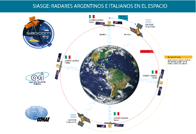
It should be noted that the two SAOCOM satellites are included in the SIASGE System, which is composed of the four Italian COSMO – SkyMed satellites plus the two Argentine satellites.
The main objective of SAOCOM 1A and for which this satellite of more than 3 tons is launched into space, is to observe the Earth and obtain measurements of soil moisture in an operational manner, so that emergency applications, such as the detection of spills of hydrocarbons in the sea or monitoring of flood coverage. But we can also talk about agrarian objectives, since it will allow this sector to benefit from the images, about 200 per day, that the satellite will collect from space.
Objectives of SAOCOM 1A
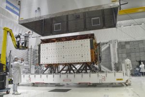
Packing of the folded satellite in the SAOCOM 1A container at the INVAP facilities in Bariloche for transfer to Vandenberg Base (California)
This first satellite will be launched into orbit from the Vandenberg Base, of the United States Air Force, on the coast of California, by the Falcon 9 rocket, from SpaceX. The main objectives of the mission correspond to the SAR space radar capabilities (Synthetic Aperture Radar – or “synthetic aperture” -) polarimetric band developed by Argentine engineers to operate on board the SAOCOM satellites:
- Provide information on the Symmetric Aperture Radar (SAR) polarimetric band regardless of the weather conditions and the time of day, from different areas of the earth, in real time and in stored mode, with a spatial resolution between 10 and 100 meters and with different viewing angles.
- Obtain specific products derived from SAR information, particularly maps of soil moisture, which represents a great help for agriculture, hydrology and for the health area, due to its proven socio-economic impact.
- Satisfy the applications considered in the Space Information Sectors of the Argentine National Space Plan.
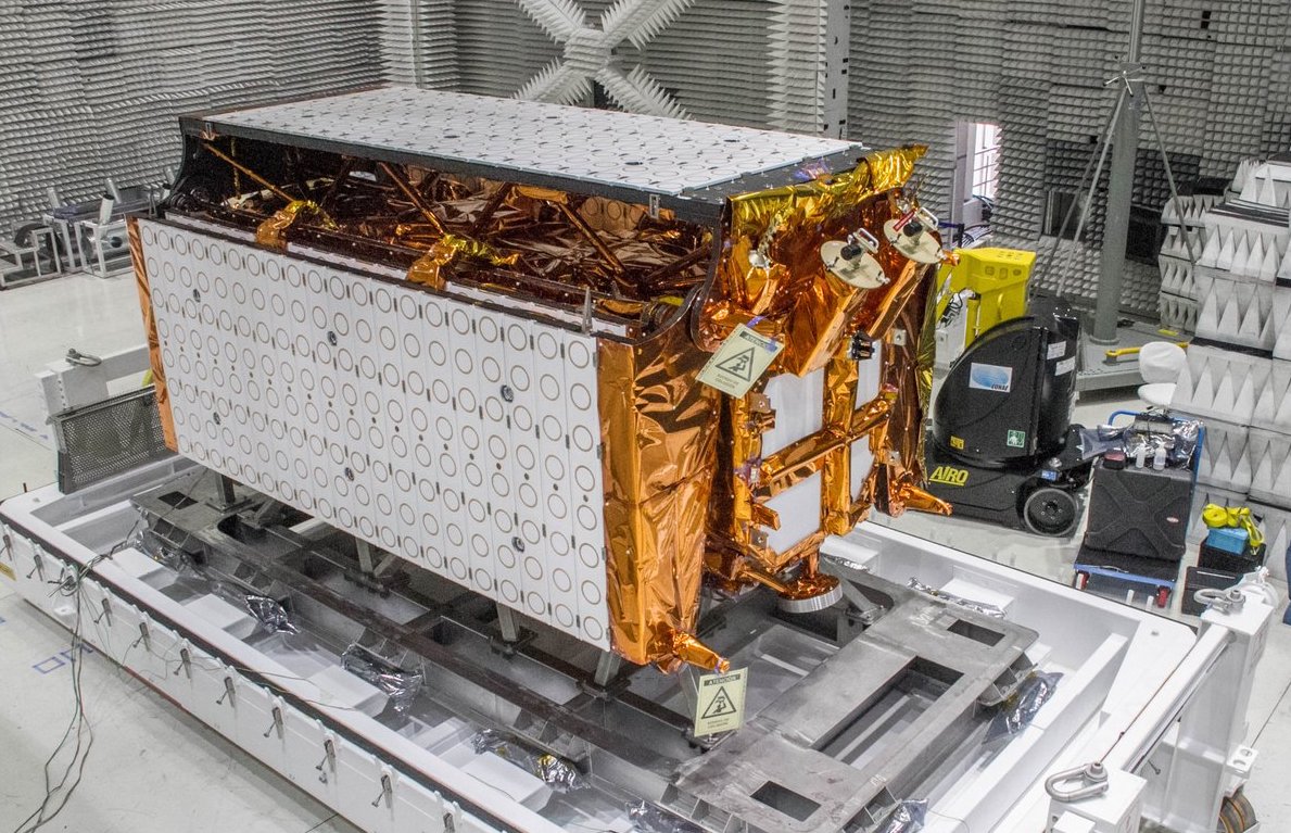
Packing of the folded satellite in the SAOCOM 1A container at the INVAP facilities in Bariloche for transfer to Vandenberg Base (California)
It is expected that soil moisture maps will be obtained over an area of more than 83 million hectares of the Pampas region of Argentina in short periods of 6 days. Due to the importance of these maps for the agricultural sector, they are called strategies since they have an important socioeconomic impact.
The central applications to this project can be divided into three, where two of them are directed to agriculture and a third to hydrology, of which the following general objectives should be highlighted:
- provide support to agricultural producers in the decision-making process related to planting, fertilization and irrigation, in crops such as soybean, corn, wheat and sunflower, for example, to optimize the use of fertilizers,
- provide support to agricultural producers in relation to the use of agrochemicals (fumigation) for the control of diseases in crops, in particular for the fusariosis of the ear of wheat,
- improve the management of hydrological risks and emergencies, enhancing hydrological modeling and forecasting capacity, in order to minimize economic losses due to floods.

Radar antenna in the Laboratory of Integration and Testing (LIE) of CONAE at the Space Center Teófilo Tabanera in Córdoba
Technical Characteristics
| wdt_ID | Instrumento | SAR band L polarimétrico |
|---|---|---|
| 1 | Frecuencia central | 1,275 GHz |
| 2 | Orientación de la observación | A derecha en forma de operación nominal (con capacidad de observar a la izquierda) |
| 3 | Resolución espacial | 10 a 100 m (según el modo de adquisición) |
| 4 | Ancho de barrido | 20 a 350 km (según el modo de adquisición) |
| 5 | Rango de ángulos de incidencia | 20 a 50 grados (según el modo de adquisición) |
| 6 | Rango dinámico (coeficiente de retrodispersión radar) | - 35 dB a 5dB |
| 7 | Exactitud de posicionamiento geográfico (con compensación de efectos topográficos) | 25m (órbita precisa de 18 días) - 70m (órbita precisa de 48 horas) - 90m (órbita a bordo) |
| 8 | Exactitud radiométrica absoluta | 0,5 dB |
| 9 | Exactitud polarimétrica | 0,3 dB |
| 10 | Modos de adquisición | StripMap, TOPSAR Narrow, TOPSAR Wide |
| Instrumento | SAR band L polarimétrico |
Other characteristics of SAOCOM 1A are detailed below:
The operating modes are classified as:
- Operational – satisfies all quality requirements and resolution specifications
- Technological – include technological innovations in order to evaluate improvements in performance
- Calibration – obtain measurements dedicated to the calibration of the SAR instrument and noise estimates
The available polarizations are:
- Single Polarization: the system emits and receives in the same linear polarization (horizontal-H or vertical-V), that is to say HH or VV.
- Double Polarization: the system emits in a linear polarization and receives the two linear polarizations simultaneously, that is to say HH and HV, or VV and VH.
- Quad Polarization: the system alternately emits both linear polarizations and receives them simultaneously, ie HH, HV, VH and VV.
- Circular Linear Polarization: the system transmits a circular polarization (right-right or left-left) and receives two linear polarizations simultaneously, ie right-H and right-V or left-H and left-V.
The available acquisition modes are:
- StripMap, with Simple, Double or Quadruple (Full) polarization. In this mode the radar points to a given fixed direction while capturing a continuous strip, which corresponds to the narrowest sweeps with the highest spatial resolution.
- TOPSAR Narrow, with Simple, Double or Quadruple (Complete) polarization. In this mode, the radar changes its pointing along the trace to capture several strips, thus covering a larger scan width with lower spatial resolution than in the StripMap case.
- TOPSAR Wide, with Simple, Double, Quad (Complete) or Compact polarization (technological mode). In this case, the radar changes its pointing along the trace to capture a greater number of strips, thus covering a wider sweep width with lower spatial resolution than in the TOPSAR Narrow case.
All acquisition modes in the Simple, Double and Quadruple (Full) polarization modes are operational. The TOPSAR Wide mode with Compact polarization corresponds to a technological mode.
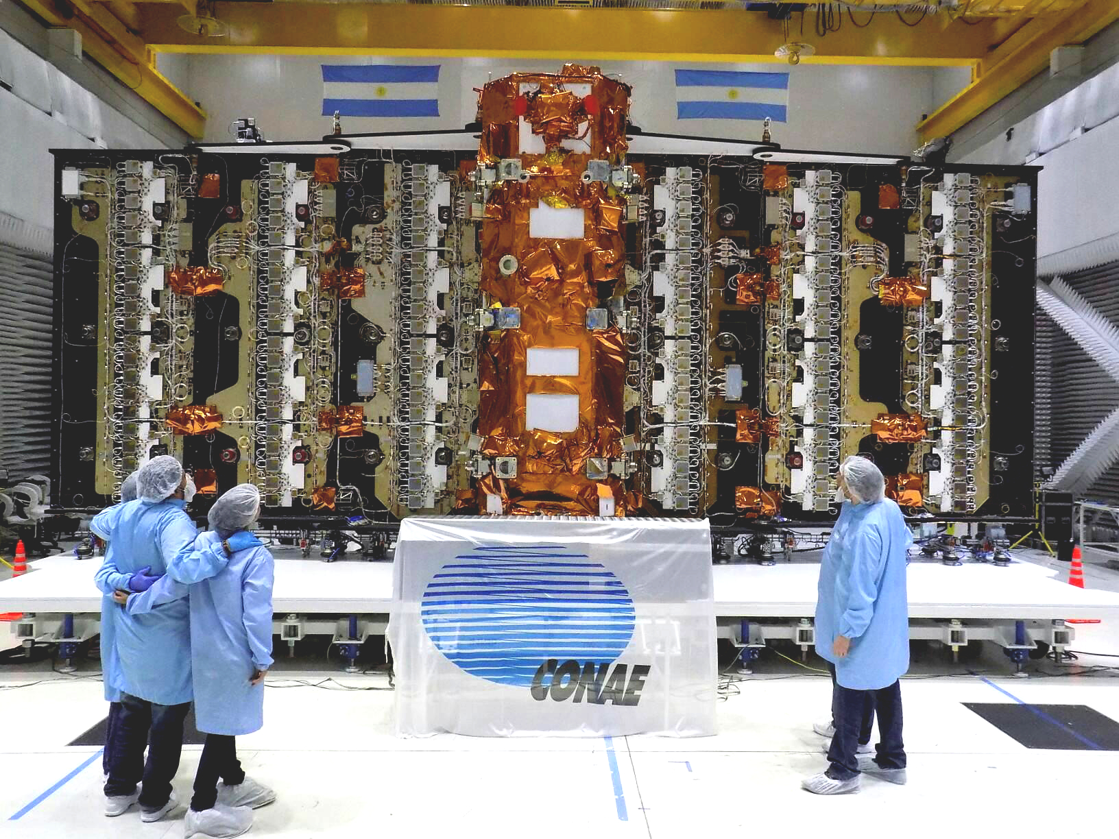
SAOCOM 1A with the radar antenna deployed in CEATSA / INVAP
- Quantum Key Distribution - 7th November 2022
- Conducted Immunity - 20th May 2019
- Electrical transients Test - 2nd May 2019


